Location Map

Amenities @ The M condo
| Catergory | Amenites | Approx Distance |
| MRT Station | Bugis MRT (DT14,EW12) | 0.22 km |
| Rocher MRT (DT13) | 0.35 km | |
| Bencoolen MRT (DT21) | 0.43 km | |
| Schools | Nanyang Academy Of Fine Arts | 0.24 km |
| Boston Business School | 0.33 km | |
| UNLV SIngapore | 0.44 km | |
| Arium School of Arts and Sciences | 0.46 km | |
| Learninghub Global Institute | 0.46 km | |
| Seed Institute | 0.46 km | |
| Stamford Primary School | 0.52 km | |
| St Margaret’s Primary School | 0.88 km | |
| Farrer Park Primary School | 1.36 km | |
| Anglo- Chinese School (Juinor) | 1.60 km | |
| Chatsworth International School | 1.69 km | |
| Groceries & Supermarts | NTUC 1 Rochor Road | 0.25 km |
| Cold Storage Bugis Junction | 0.26 km | |
| SHeng Siong The Verge | 0.48 km | |
| Cold Storage Plaza Singapura | 0.95 km | |
| Shopping Malls | Bugis+ | 0.13 km |
| Parco Bugis Junction | 0.25 km | |
| Sim Lim Square | 0.29 km | |
| The Cathay | 0.66 km | |
| Raffles City Shopping Centre | 0.72 km | |
| Suntec CIty Mall | 0.91 km | |
| Plaza Singapura | 0.95km | |
| Peninsula Plaza | 0.95 km | |
| Food Centre | Albert Centre Market & Food Centre | 0.09 km |
| Tekka Centre | 0.72 km | |
| Berseh Food Centre | 0.84 km | |
| Golden Mile Food Centre | 1.17 km | |
| North Bridge Road Market/Food Centre | 1.28 km | |
| Other Amenities | Central Public Library | 0.34 km |
| Fort Canning Park | 1.03 km | |
| Esplanade Park | 1.09 km | |
| Jalan Besar Sports and Recreation Centre | 1.24 km | |
| Farrer Park Tennis Centre | 1.32 km |
(Disclaimer: All indicated distances and travel time above from The M are approximate only.)
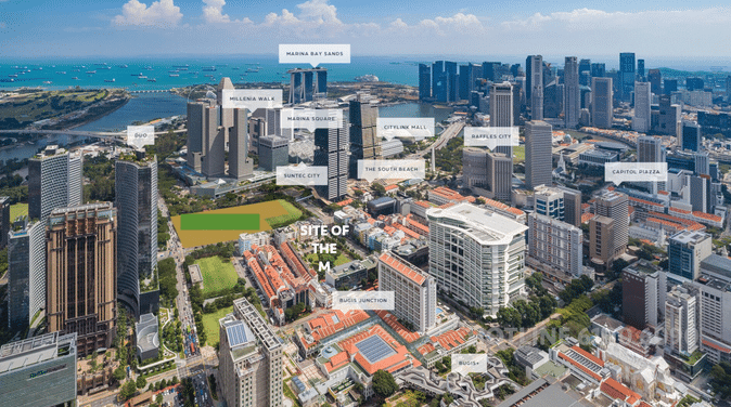
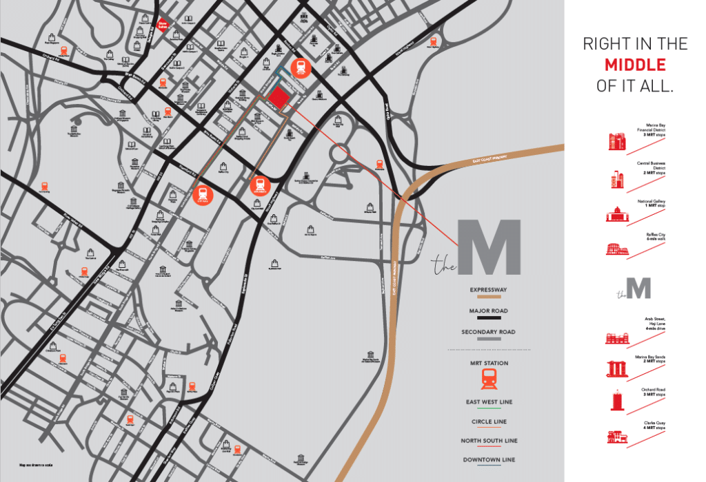
The M is situated at Middle Road of Singapore which is minutes way to both Bugis and Rochor MRT stations. It is only 3 MRT stops to the Central Business District.
For parents sourcing for schools enrollment, St Margaret’s Primary School, Farrer Park Primary School, Nanyang Academy of Fine Arts, School of the Arts Singapore (SOTA), Anglo-Chinese School (Junior) and Singapore Management University are all within close proximity.

[bottomText]
